Le tour du rocher de Combau
Ajouter au carnet de voyage
- Distance10.57 km
- Duration4h30
- TypeCircular
- DifficultyDifficult
- Total altitude change+ 720 m
- Departure/arrivalChâtillon-en-Diois
- Route markingYes
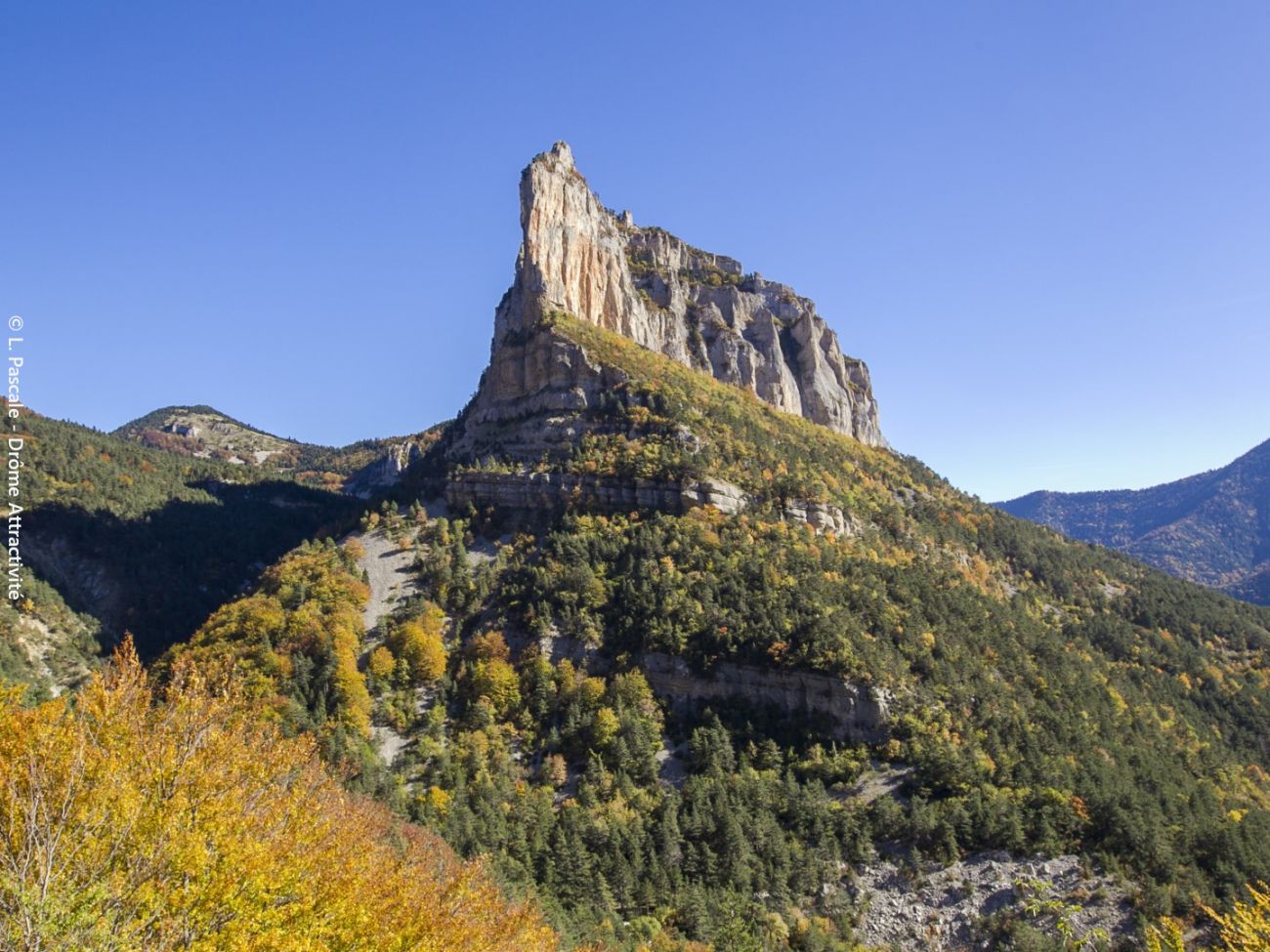
Admire all the facets of this little Mont Aiguille, whose immense, tapering rocky blade stands sentinel-like, guarding access to the treasures of the Vercors high plateaux nature reserve: Glandasse cliffs, Archiane cirque, val...
- AddressLes Nonières
Route du col de Menée
26410 Châtillon-en-Diois - Phone04 75 22 03 03
- Emailcontact@diois-tourisme.com
- WebsiteSee the website
Our tips
- Details about route marking :
Balisage jaune et vert (PR) et blanc et rouge (GR) avec poteaux de signalétique directionnelle. - Difficult stretches :
Longue montée jusqu'au col et descente dans des éboulis. - Références topographiques :
Topoguide "Le Diois à pied - Aux sources de la Drôme" de la Fédération Française de Randonnée.
Carte Vercors-Diois du PNR Vercors - Map references :
TOP25 IGN 3237
Drôme Tourisme cannot be held responsible for any problems encountered along the route.
Any problems encountered can be outlined here:
Author: Conseil Départemental de la Drôme - Apidae Tourisme
To show the map
0M
0M