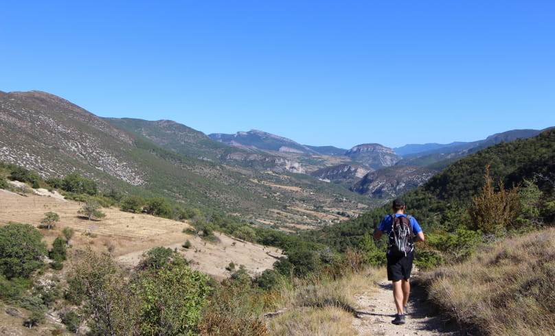
Crête des Lichières
The majestic Montagne d'Angèle keeps watch over you throughout the hike, while the peaks of Bramard and Montagne du Poët to the south and Miélandre, Cougoir, Vautour and La Lance to the west recall the mountainous side of the Baronnies. On the natural side, Austrian black pines predominate, having been planted at the end of the 19th century to combat slope erosion, while on the ubac (north), beech trees are present and diversify the vegetation. As an added bonus, the Villeperdrix Sensitive Natural Area (Espace Naturel Sensible de Villeperdrix) offers information tools for the general public, enabling you to discover this remarkable natural area between the Angèle and Buègue peaks, intersected by the Léoux valley.
Departure point: village entrance, park along the wall opposite the cross or the salle des fêtes sign.
1. Don't go up into the village, go down opposite the "salle des fêtes" sign (opposite the cross next to the hiking information sign) on the small road that goes down to the right, "Chemin du Plan des Rieux".
2. At the "Haut Cimetière alt. 470 m" signpost, turn right to leave the road and take the path to Les Barnauds. Pass the wastewater treatment plant and stay on the lower track, which turns left. Continue on the little path below to reach a small bridge spanning the Naysses stream, and cross it before heading uphill on a steep track.
3. At the end of the climb, on the level, turn right onto the path with staircase-like rock slabs, leaving the farm track on the left.
4. Reach the "Les Barnauds alt. 500m" post on the track, then follow "Col Maruen". Be careful, take the track for 30m and leave it directly for a small path that climbs to the left in the marl. Follow the
left of the valley, before crossing it a little further on and climbing steeply up natural steps. Always stay on the single balcony path, which levels out and runs alongside an ONF forest to the pass.
5. At the "Col Maruen alt.780m" sign, turn right onto the path heading north.
6. Enjoy the view of Angèle, Miélandre, Vautour, la Lance and Cougoir in the distance. 500m after the pass, keep your eyes open and leave the main track for a narrow path to the right through the boxwoods, before finding a wider
path.
7. After the crests overlooking the small Villeperdrix plateau, join a wide track and continue straight ahead.
8. In the undergrowth, keep right on a narrow path that descends steeply through beech and pine trees.
9. Reach the lawns after the forest, and 10 m before the "Col de Chaudebonne alt. 763m" sign, take a path in the grass which forks right at a hairpin and descends towards the village. Do not take the GRP (yellow and red) to Villeperdrix, nor the main track, which is closed and private.
10. The little path quickly becomes a footpath, then a track, and descends steeply into the marl, following the GRP markings (yellow and red). The landscape opens up, we pass an orchard and continue towards the village, following the signs.
11. Cross a stream (dry most of the time) and go back up to the opposite side of the path, continuing straight ahead (olive groves, then an enclosure on your right).
12. Rejoin the road and the village, continue straight on to the fountain before returning to the "Route de Villeperdrix" start.
- Address26510 Villeperdrix
Drôme Tourisme cannot be held responsible for any problems encountered along the route.
Any problems encountered can be outlined here:
Author: Conseil Départemental de la Drôme - Apidae Tourisme

