Heritage and vineyards
Pedestrian sports, Hiking itineraryThis walk will enchant you with its vestiges, its ruins and its Côtes du Rhône vineyards with the sweet scent of garrigue plants.
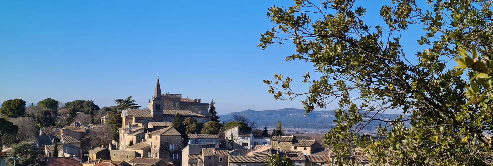
Start at the Parking de la Chapelle car park. Cross the county highway opposite the Chapelle Saint Denis and the cemetery, at the stop sign, and take the Rue du Portail. At the end of the street, with a medieval gateway on the right, turn left into the Rue Marquis Robert d’Acquéria and enjoy the view of the church (the Église Sainte Anne), the Tower and the Château. After the footbridge, carry straight on uphill to arrive in the Place du Château.
There is an incredible panoramic view from here, from Mont Ventoux on the right to the mountains of the Lance and the Trois Becs on the left. Carry on, descending slightly, enter the Chemin du Colombier and follow it for a few hundred yards. At the end, cross the road and enter the Impasse des Glycines.
Go along the track on the left, then when it climbs take the dirt track on the right (with a sign indicating "Interdit aux vélos" or "no bicycles"). Follow this track along to an asphalt road, then follow the Chemin du Cordolen. Keep going straight on (with a fine view of the vines) and, a little further on, you will see the church of the Église des Aubagnans, with the Château of Suze-la-Rousse in the background.
At the intersection, take the Chemin des Fournas, a dirt track that runs through the woods. At the end, you will find the "borie".
A borie is a round cabin with dry-stone walls and roof which served as a barn, stable and seasonal home for a farmer.
Pass it on the right and carry on along the track between lavender on one side and vines on the other (and a splendid panorama).
At the end, where the track meets the road, turn left.
Be careful when crossing this very busy county highway, and take the Chemin des Demoiselettes.
Go past the church - the Église Notre Dame des Aubagnans - and its priory and continue along this rather rocky dirt track, with unbeatable views of Mont Ventoux, between oak trees and vineyards. Cross the county highway, paying attention (very busy road) and carry straight on along the Chemin des Damoiseaux.
After the house, take the second on the right and continue between vines, oaks, olive trees and lavender. Where it forks, take the track ahead of you, with a view of the village and the virgin. At the end, at the cross, turn left onto the county highway. Cross straight over and stay on the right. 500 yards further on you will find the entrance to the village.
At the roundabout, you have several pedestrian crossings which will take you to the old village via the Avenue des Côtes du Rhône. On your way, you can admire the Fontaine du Calvaire on the right and the Chapelle Sainte Philomène on the left. Go past the Grande Fontaine, the Lavoir (communal laundry / wash-house) and the Mairie (the town hall). Carry on along the pavement in the general direction of Uchaux (on the D 117) to return to your start point.
Our services
- Free car park
- accepted animals
Further information
- Free car park
- Type 2 socket
- Car park
- Public WC
- Charging stations for electric vehicles
- Defibrillator
- Play area
- Picnic area
Opening
All year round.
Prices
Free access.
Télécharger les médias
Through Office de Tourisme Drôme Sud Provence


