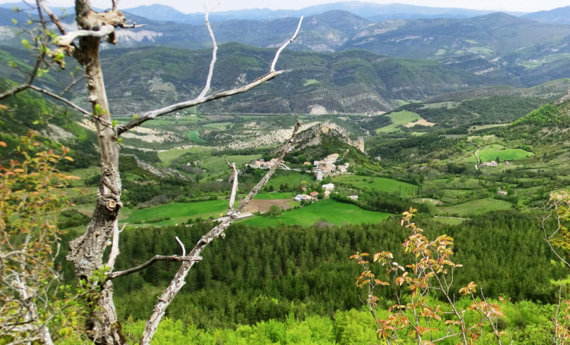
La Dragonnière
This mineral was crushed, reconstituted with cement, polished and then cut into tiles for flooring.
Departure point: "Ballons, alt.820 m" town hall parking lot.
1. Turn left after the church, and 200 m further on at the crossroads, go straight on uphill. Pass the cemetery and, 700 m further on, turn slightly right at the fork in the road.
2. At a bend in the road, at "Les Pommeries, alt.900 m", turn slightly left onto a smaller track. Follow the main route; after 1.2 km, the track splits.
3. Turn left, and the track becomes a path on a fairly steep slope. At a crossroads just before the highest point, continue uphill to reach the "Pas de Ste Colombe, alt.1271 m".
4. Turn left and descend into the undergrowth on the north-facing slope.
5. At "La Touisse alt.1130 m", fork left onto a pretty balcony path; follow it until you reach the "Piste du Lavavour alt.1170m" junction. View of the Dragonnière rock on the right.
6. Take the track on the left which leads to the "Lavavour, alt.1210 m".
7. From here, take the path on the left that climbs up to "Pas du Lavavour 1271 m".
8. At the Pas, continue right along the ridge, then descend on the north-facing slope (undergrowth). Further on, the path becomes a track and follows the mountainside towards "Col St Jean, alt.1159 m".
9. Just before reaching the road, go up to the left, the path passes on the other side (viewpoint) then, after descending on the shoulder of the mountain, the track turns left. Continue straight ahead: the track then
(view of Lachau) to a crossroads.
10. Turn left. Follow the trail for 900 m to the hamlet of "La Bégüe, alt.800 m".
11. At the D 170 b, turn left onto the road to Ballons.
- Address26560 Ballons
Drôme Tourisme cannot be held responsible for any problems encountered along the route.
Any problems encountered can be outlined here:
Author: Conseil Départemental de la Drôme - Apidae Tourisme

