Le Jocou et le col du Pigeon
Ajouter au carnet de voyage
- Distance8.12 km
- Duration4h
- TypeCircular
- DifficultyDifficult
- Total altitude change+ 726 m
- Departure/arrivalGlandage
- Route markingYes
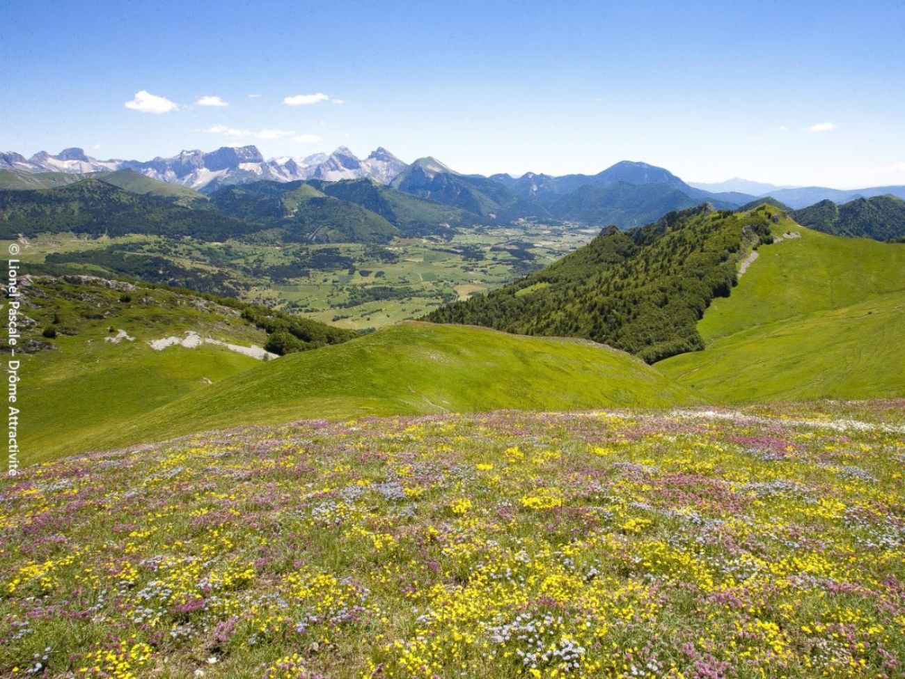
This is the flagship summit of the south-east Vercors. Set in alpine pastures, you can enjoy 360° panoramic views on this round trip to the crossroads of the Vercors, Trièves and Dévoluy, accompanied by the gliding flight of griffon vultures in search of food.
- AddressRoute du col de Grimone
26410 Glandage - Phone04 92 58 51 85
- Emailluslacroixhaute@diois-tourisme.com
- WebsiteSee the website
Our tips
- Details about route marking :
Balisage jaune et vert (PR) avec poteaux de signalétique directionnelle. - Difficult stretches :
Sommet à éviter les jours de grand vent. - Map references :
TOP 25 IGN 3237
Drôme Tourisme cannot be held responsible for any problems encountered along the route.
Any problems encountered can be outlined here:
Author: Conseil Départemental de la Drôme - Apidae Tourisme
To show the map
0M
0M