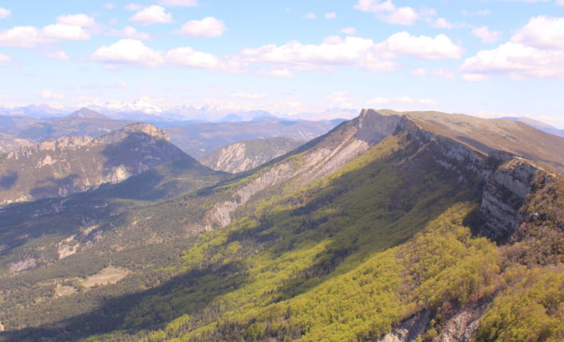
Le sentier Emile
In fact, it is said that its inhabitants attacked a column of Hannibal (an illustrious Carthaginian military leader) in the 3rd century BC! Finally, on the way back down, you'll pass Pas du Loup, also known as Saut du Loup, where legend has it that a wolf cornered by hunters jumped from one bank to the other at the narrowest point to escape.
Departure point: On the village square, in front of the Tourist Office and the Maison des Vautours.
1. At the "Rémuzat - Champ de mars alt. 448 m" sign in front of the bus shelter, follow the signs for "Place Rolland" towards the village center, to the right of the Tourist Office.
2. Take the street leading up into the village to the left of the former hotel restaurant (narrow street opposite the "Place Rolland" sign). Leave the village, following the signs which go slightly left into the streets.
3. Pass a calvary (cross) and follow the asphalt road up to the heights. Leave the road, which descends to the left, and keep straight on at the "La Guindonnière" milestone. Continue along the road, which becomes a track.
4. At the "Béatrix alt. 500 m" post, continue towards Les Aiguilles on the main track. A little further on, stay on this main track, which bends to the right and then to the left. The track becomes flat.
5. After a stone cottage on your left, watch out for and turn right onto the start of a wide path that rises due east at the corner of a house at the "Beausoleil alt. 530 m" post on the "Château d'Eau" path. Further on, continue along a smaller path to the right, before shortly afterwards turning left onto a small path which climbs steeply. Continuing on, cross the beech forest before reaching the Pas de l'Eygues, pass through a small stream with handrails before continuing your ascent through the pine forest and reaching a first flat.
6. Turn right onto the grassy path which leads to a track and the sign "Sous l'Enclus alt. 1025 m".
7. Turn right and follow the level track until you reach a new crossroads. Go straight ahead and leave the track descending to the right. The descent twists and turns until you reach the ledge of a cliff, which you should cross with care. Continue downhill along the switchbacks to the Rif stream.
8. Stay on the right bank of this stream, and continue straight on at the post "Ruisseau du Rif - alt. 780 m" towards Rémuzat and Ubac de Montrond. Pass the ruins of the village of Clermont in the middle of a meadow.
9. Further on, cross over to the other side of the stream, then climb slightly to reach the "Ubac de Montrond - alt. 780 m" post and continue straight on towards Rémuzat.
10. Cross the track to Rémuzat (post "Bonos alt. 741 m"). After a few hairpin bends, rejoin the track and follow it to the left at a marker indicating Rémuzat and Pas du Loup.
11. Reach the "Pas du Loup alt. 632 m". Leave the track and descend to the right towards the "Rif" stream, then return to Rémuzat on the Béatrix path (aerial and technical), which overlooks the village and eventually joins a track taken on the outward journey, then a road leading back down to Rémuzat.
Return option: You can return to Rémuzat via the track at Pas du Loup and take the Clos Nogier path a little further down on the left, leaving the main GRP track on a narrow, busy road. The path climbs slightly through the woods before levelling out and descending into the marl on Rémuzat.
- Address26510 Rémuzat
Drôme Tourisme cannot be held responsible for any problems encountered along the route.
Any problems encountered can be outlined here:
Author: Conseil Départemental de la Drôme - Apidae Tourisme

