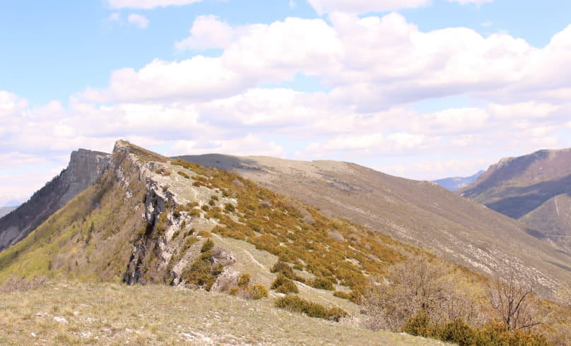
Les Aiguilles
With one of the finest panoramas in the Baronnies, the Aiguilles de Rémuzat and its ridges stretching northwards offer a unique view of the Ventoux to the south, the Dévoluy to the northeast and the Montagne d'Angèle to the west, the Drôme's flagship peak. There are also glimpses of the very alpine Raton crests, with their northern slopes covered in beech and fir trees, dwarf juniper and the marmot that seems to have settled here. Finally, the view clearly identifies the landscape structured by watercourses, with
the succession of valleys (from south to north): Toulourenc, Ouvèze, Ennuyé, Eygues, Oule and Drôme.
Departure point: On the village square, in front of the Tourist Office and the Maison des Vautours.
1. At the "Rémuzat - Champ-demars alt. 448 m" sign in front of the bus shelter, follow the signs for "Place Rolland" towards the village center, to the right of the Tourist Office.
2. Take the street leading up into the village to the left of the former hotel restaurant (narrow street opposite the "Place Rolland" sign). Leave the village, following the signs which go slightly left into the streets.
3. Pass a calvary (cross) and follow the asphalt road up to the heights. Leave the road, which descends to the left, and keep straight on at the "La Guindonnière" milestone. Continue along the road, which becomes a track.
4. At the "Béatrix alt. 500 m" post, continue towards Les Aiguilles on the main track. A little further on, stay on this main track, which bends to the right and then to the left. The track becomes flat.
5. After a stone cottage on your left, watch out for and turn right onto the start of a wide path that rises due east at the corner of a house at the "Beausoleil alt. 530 m" post on the "Château d'Eau" path. Further on, continue along a smaller path to the right, before shortly afterwards turning left onto a small path which climbs steeply. Continuing on, cross the beech forest before reaching the Pas de l'Eygues, pass through a small stream with handrails before
continue your ascent through the pine forest and reach a first level.
6. Turn right onto the grassy path which leads to a track and the sign "Sous l'Enclus alt. 1025 m". Follow it to the left as far as "Col de l'Enclus alt. 1075 m".
VARIATION: if the start of the hike is too strenuous, you can return via the Émile trail (turn right at the "Sous l'Enclus" post, about 8 km instead of 12 km along this trail to Rémuzat, i.e. 1h30 less). To do this, take sheet 6 of the guidebook and follow the signs from point 7.
7. At the pass, leave the track to take a path to the right which heads towards the mountain, and after two hairpin bends, take the path to the right which climbs in a straight line before taking several hairpin bends through scree to reach a pass under the Aiguilles.
8. Follow the path to the right and cross the rocks using the handrail (be careful) to reach the summit of Les Aiguilles (1362 m) and enjoy the view. Follow the ridge path to the left, heading south then east for 1.5 km. Be very careful when passing close to the edge!
9. After about 45 minutes' walking, look out for a small hollow at the "Pas de la Pousterle alt. 1346 m" marker, where a hairpin path leads off to the right through the broom towards the sheepfold below. At the "Serre Bernard alt. 1105m" post, continue straight ahead on the main track towards Col de Lemart and Montrond, always staying on the leftmost track.
10. On the descent, at the end of a large bend to the left at the "Col de Lémart alt. 910m" post, leave the track and take a path that descends to the right towards Rémuzat and the Cabane de Clermont.
11. At the "Cabane de Clermont alt. 780 m" post, continue on the right-hand path towards "Ruisseau du Rif" and "Rémuzat". At the "Ruisseau du Rif alt. 780 m" post, stay on the track towards Rémuzat before leaving it a few metres further on for a path that goes off to the left into the woods.
12. Pass the ruins of the old village of Clermont before heading up the valley, follow the signs and rejoin the track at the "Ubac de Montrond alt. 780 m" post. Follow the path down towards Rémuzat and continue straight ahead, crossing the track at the "Bonos alt. 741 m" post. After a few hairpin bends, rejoin the track and follow it to the left at a signpost indicating Rémuzat and Pas du Loup.
13. Reach the "Pas du Loup alt. 632 m". Leave the track and descend to the right towards the "Rif" stream and return to Rémuzat on the Béatrix path (aerial and technical), which overlooks Rémuzat and eventually joins a track taken on the outward journey and then a road leading back down to Rémuzat.
RETURN VARIATION : You can return to Rémuzat via the track at Pas du Loup and take the Clos Nogier path a little further down on the left, leaving the main GRP track on a narrow, busy road. The trail climbs slightly through the woods before levelling out and descending into the marl on Rémuzat.
- AddressPlace du Champ de Mars
26510 Rémuzat
Our tips
- Difficult stretches :
Présence de passages délicats réservés aux randonneurs expérimentés. - Références topographiques :
Fiche disponible dans les offices de tourisme
Drôme Tourisme cannot be held responsible for any problems encountered along the route.
Any problems encountered can be outlined here:
Author: Conseil Départemental de la Drôme - Apidae Tourisme

